
Venturing through the Bayug Forest on the quadruple boundary
By APR Datu
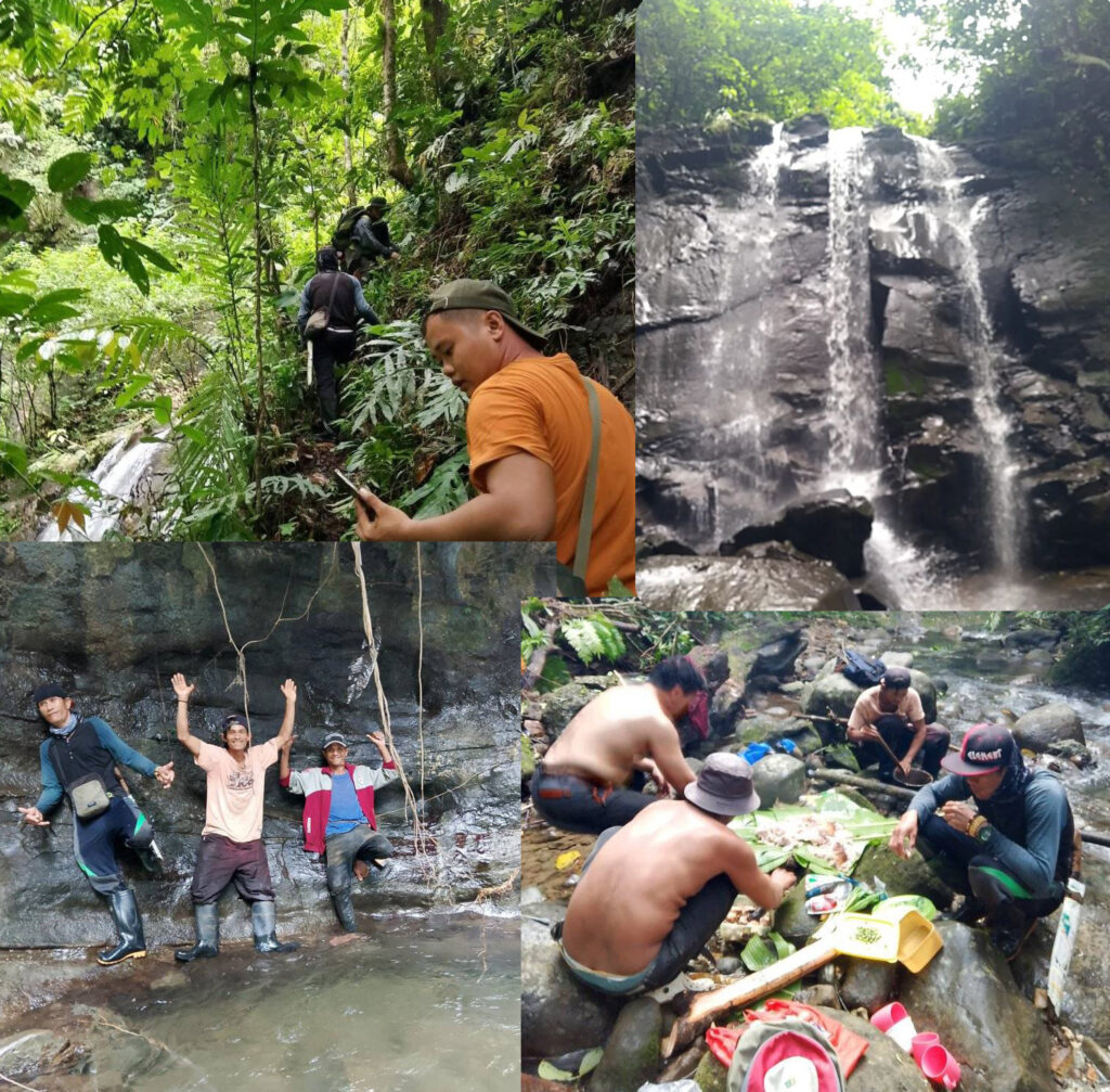
Few had heard about the Bayug River in Cagayan de Oro City. Even in Iligan City where it flows into its delta at Iligan Bay, the river is not known as the Bayug but rather as the Mandulog where it had established a negative reputation as the flood channel of typhoon Sendong. In the highlands of Talakag, Bukidnon however, especially near the quadruple boundaries of Cagayan de Oro City, Talakag, Bukidnon, Iligan City and the Province of Lanao del Sur, the Bayug River stands at the center of the Higaonon way of life. For one, the upland source of the river is the traditional homeland of the Higaonons and its relative Bukidnon tribe, the Talaandigs. While the Talaandigs pride themselves as being the sons and daughters of the Andig River, the Bayug River winds slowly downward towards Iligan Bay from its source at Mount Kaliyanliyan at Dominorog, Talakag, Bukidnon. The Bayug River, though, is a hidden gem of sorts in the middle of the lush rainforest between Bukidnon and Lanao del Sur. Its highest cataract, the Mindamora Falls is a two tiered waterfall stunning to look at and refreshing to bathe. I am saying this first hand as I had been to the place many times already, immersing not just in its cool waters but more so with the experience of jungle trekking, of pure wanderlust. We had a more than fifty kilometers extreme hike in the tropical rainforest of the Bayug watershed and the experience was more than worth the pain. We searched for the elusive Caramatay falls which we never actually reached. The series of cataracts however of the Migcayagan Stream more than compensated for the missed objective where the wonder of the flow of the stream missing on the next bend was awesome at its best, and it reappears on another bend.
there were myriads of streams within the Bayug watershed. Each narrow valley harbors a steady flow of water trickling from the numerous root systems of trees. The sight of water combined with the vegetation makes a scene out of a tropical paradise. There are many ingress points to reach the heartland of the boundless woodland. The main one was the one used by the logging concession of Vicmar which used to have a bridge crossing the rapids of the mighty river. Others were used by hunters who frequented the place in search of game. The one we used on the February 2024 hike was the Bayawa trail which led us to the Camanagaan Stream. The one that we used last October 27, 2024 was the Garbon trail that led us to the Pamalagat Stream. The trail started at the low inclination from the paved Iligan – Bukidnon Road. It winds slowly towards a narrow valley that separates the Bayawa ridge from the Panalamin heights. Few outsiders know of the terrain save for old time lumberjacks who worked with the Dacudao Lumber Company before. To be continued …